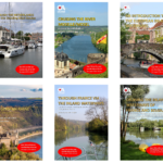
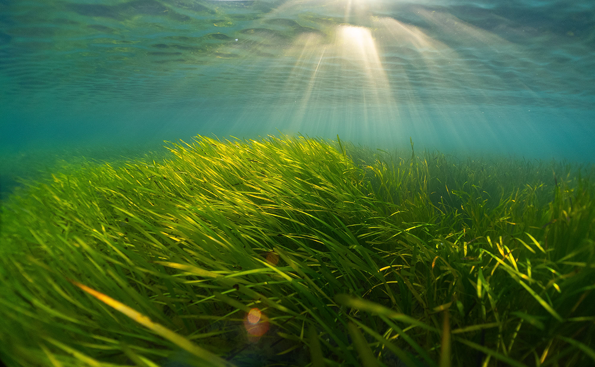
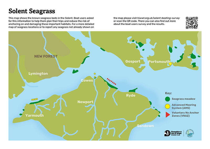
A new interactive map is helping boaters across the Solent protect seagrass, one of the UK’s rarest marine habitats. It shows the locations of known seagrass meadows, helping skippers to avoid anchoring on them and reduce the risk of damaging these precious habitats.
In busy coastal areas like the Solent, seagrass can be particularly vulnerable to damage from anchoring. Anchors and chains can uproot the seagrass, releasing stored carbon and pollutants, and destabilising the seabed, which makes our coastlines and boating channels vulnerable to shifting sediments and coastal erosion.
Seagrass meadows are particularly important in the Solent, where sheltered bays and tidal waters create ideal conditions for safe anchoring and areas for these rare habitats to flourish. Home to species including pipefish, cuttlefish and thornback rays, they also support local jobs in fisheries by providing nursery grounds for fish such as bass.


Once damaged, seagrass can take many years to recover. Across the UK, seagrass meadows have declined by up to 90 per cent in the last century, making the remaining beds in the Solent particularly valuable and in need of careful protection.
The map was developed in response to the Trust’s Solent Boating Survey, which gathered insights from nearly 600 boat users in the Solent and was carried out as part of the Solent Seascape Project. The survey showed strong awareness of seagrass and its importance, but identified a lack of clear, trusted information about seagrass locations as one of the main barriers to avoiding damage while anchoring.
 Emily Stroud, Marine Nature Recovery Manager at Hampshire & Isle of Wight Wildlife Trust said: “Seagrass meadows are hidden worlds beneath the waves, vital for so much wildlife and the health of our waters and planet, thanks to their oxygen production and rich habitat structure.
“But they can be difficult to identify from the surface, particularly in busy anchorages. When boats anchor in seagrass it can lead to serious damage – not just for the seagrass but for us as people. Uprooted seagrass reduces shelter, nursery habitat and food sources for many species that rely on these beds. The damage takes years to recover, even with our help.
“This map was developed with boat user insights and values in mind to help them anchor outside seagrass habitats while enjoying their journeys and day trips out on the water. It was created in collaboration with the boating community, harbour authorities, and sailing organisations including the RYA, so skippers can see where seagrass is and contribute to its protection and benefits, while still enjoying their time on the water. The map acts as a planning tool, providing practical guidance for choosing where to anchor, identifying where advanced mooring system are available for overnight stops, or finding sheltered spots in the stunning Solent bays.
“Good information is essential for safe and responsible boating. This map gives skippers an extra layer of local knowledge to support their decisions on the water.
“Boaters told us that knowing where seagrass is located makes a real difference. 63% of our surveyors said they would anchor outside seagrass is they knew it was there. This map responds directly to that need, and it will continue to improve as more people share what they’re seeing on the water.”
Alongside the map, boaters can also play an active role in improving knowledge of the Solent seabed. Seagrass that does not currently appear on the map can be reported, with sightings submitted using a Seagrass Spotter app. These contributions will help refine the map over time and build a clearer, more accurate picture of Solent habitats, shaped by the boating community itself.
Meg Roberts, Environment Officer at Langstone Harbour Board said: “We’re really pleased to see this new map available for boaters across the Solent. Clear, reliable information about where seagrass meadows are located is essential for helping people to make informed anchoring choices, and this tool fills a gap that local skippers have been asking about for some time.
“We have included this map in our Harbour Guide this year because it gives boaters the local knowledge they need to choose suitable anchorage locations while still enjoying everything the harbour has to offer. Protecting the remaining seagrass in Langstone and the Solent is a shared responsibility, and this tool makes it easier for everyone to play their part in safeguarding these habitats for the future.
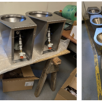
“At Langstone Harbour Board, we are developing a set of Advanced Intertidal Mooring Systems for boat owners. These moorings seek to remove the swinging chain component of traditional mooring systems, promoting seabed recovery, and will add to the growing number of AMS in the Solent region.”
The Solent Boating Survey and interactive map are part of the Solent Seascapes Project, a partnership initiative working with the boating community to keep boating enjoyable while supporting healthy marine habitats. The partnership is also working with the local community to restore seagrass, oyster reefs, saltmarsh and seabird nesting habitats across the Solent’s seascape.
The map, survey findings, and reporting tools are available at: hiwwt.org.uk/solent-boating-survey